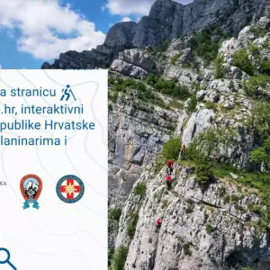
It was presented at the branch of the Public Institution "Krka National Park" in Drniš new tourist-mountaineering map made by experienced members of the Croatian Mountain Rescue Service - Station Šibenik. According to the Krka National Park, the map will make the stay in the Park more pleasant and safer for true nature lovers.
"We are extremely glad that we realized this project with the members of the HGSS, with whom we have nurtured high-quality and continuous cooperation for many years and with whom we are bound by the Agreement on Common Interest with the aim of protecting animals and property. I thank all partners in the project, who recognized its importance and supported it with their activities", said the director of the Public Institution "Krka National Park" Nella Slavica.
The tourist-mountaineering map of the "Krka" National Park was created in cooperation with the Croatian Mountain Rescue Service - Station Šibenik, the Croatian Tourist Board, the tourist boards of Šibenik-Knin County, the city of Knin and the city of Drniš, and the "Krka National Park" Public Institution.
"The trails in NP "Krka" are marked, arranged and safe, and we were most impressed by the fact that each one has its own history. With my colleague Momir Karabuva, we spent ninety hours touring the terrain and an additional forty hours processing the data. We are extremely happy and grateful that we could enjoy discovering the beauties of Krka", pointed out Antonija Mihaljević, a long-time member of HGSS.
In addition to providing a detailed description of the wider area of the Park, the map shows all educational hiking trails and viewpoints, as well as the longest cycling routes that pass through the "Krka National Park". The map was created as part of the "Cartography of HGSS" program.
"Creating maps is part of preventive activities that contribute to increasing the safety of movement and better communication between stakeholders participating in terrain search and rescue operations. For the database, in addition to printed maps, digital ones are also important because they can be updated in real time.", explained Jasmina Benčić Martinjak, head of the Cartography Department of HGSS.
The Croatian Mountain Rescue Service is a volunteer association founded in 1950 with the aim of preventing accidents and organizing search and rescue operations.
"We provide direct support to the teams of the Institute of Emergency Medicine in areas they cannot access. In the Republic of Croatia, there are twenty-five stations with a total of one thousand members who volunteer for the common good and work as part of Civil Protection. We are proud to be able to respond to all the needs of Croatian and foreign citizens", said Luka Dubravica, head of HGSS - Šibenik Station.
Finally, let's say that the new tourist-mountaineering map can be bought in the souvenir shops of the "Krka" National Park.
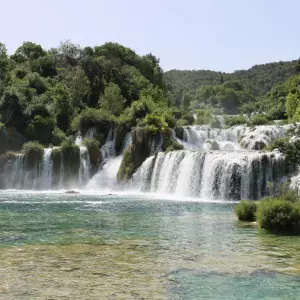
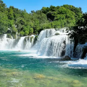
Photo: Krka National Park